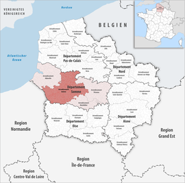
Arrondissement Amiens
Arrondissement in Frankrijk | |||
 | |||
Situering | |||
| Regio | Hauts-de-France | ||
| Departement | |||
| Coördinaten | 49°54'NB, 2°17'OL | ||
Algemeen | |||
| Oppervlakte | 2.321 km² | ||
| Inwoners (2011) | 306.527 (132 inw./km²) | ||
| Onderprefectuur | Amiens | ||
Overig | |||
| Aantal kantons | 20 | ||
| Aantal gemeenten | 281 | ||
| Insee-code | 802 | ||
| |||
Amiens is een arrondissement van het Franse departement Somme in de regio Hauts-de-France. De onderprefectuur is Amiens.
Kantons
Het arrondissement is samengesteld uit de volgende kantons:
- Kanton Acheux-en-Amiénois
- Amiens 1e kanton (Ouest)
- Amiens 2e kanton (Nord-Ouest)
- Amiens 3e kanton (Nord-Est)
- Amiens 4e kanton (Est)
- Amiens 5e kanton (Sud-Est)
- Amiens 6e kanton (Sud)
- Amiens 7e kanton (Sud-Ouest)
- Amiens 8e kanton (Nord)
- Kanton Bernaville
- Kanton Boves
- Kanton Conty
- Kanton Corbie
- Kanton Domart-en-Ponthieu
- Kanton Doullens
- Kanton Hornoy-le-Bourg
- Kanton Molliens-Dreuil
- Kanton Picquigny
- Kanton Poix-de-Picardie
- Kanton Villers-Bocage
Departementen en arrondissementen in de regio Hauts-de-France | ||||||||||
|---|---|---|---|---|---|---|---|---|---|---|
|